Aperçu
URL: http://data.adriplan.eu/uploaded/thumbs/layer-b2029a6e-9ece-11e7-a4e4-005056bd28c9-thumb.png
Dataset description:
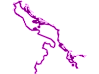
Vector (polygon) featuring Italian marine waters between the coastline and 12 nautical miles offshore.
Source: 12 nautical miles from the coast - terrestrial waters
Informations additionnelles
| Champ | Valeur |
|---|---|
| Dernière modification de la donnée | 7 décembre 2018 |
| Dernière modification de la métadonnée | 7 décembre 2018 |
| Créé le | 7 décembre 2018 |
| Format | PNG |
| Licence | License not specified |
| Has views | True |
| Id | f3e4f1dc-3ae2-432e-a42f-1556c8641451 |
| Mspkc resource type | OtherAddInfo |
| Package id | 98d40306-5412-4b6f-ab28-4ae8e496da41 |
| Position | 1 |
| State | active |
| Resource type | Other - AddInfo |

